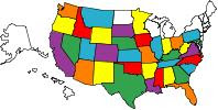
RV Travels - States Visited

RV Travels - States Visited

WELCOME

To view our blog, we have found it easier if you would click on the Archived Month located below the "About Us" article. There will be a list of posts with the oldest one at the bottom. Start with the oldest one and continue to click on each one to view the posts for that month. When you have viewed all the posts for that month then click on the next month.
Note: To view pictures, just click on them with your mouse. Hit the back arrow on your browser to return to blog.

We hope this will make it easier for you to navigate the blog and all the posts.
Enjoy the Blogspot and if you have questions concerning our travels, routes, areas of interests, campgrounds, etc., please email us at: sperrysrv@gmail.com
Showing posts with label National Park. Show all posts

Monday, July 27, 2009

THURSDAY - JULY 23RD - Grand Tetons & Yellowstone Nat'l Park, Wy.

Welcome back!
We spent the night at a very nice campground in Swan Valley, Idaho, 24 miles from the Wyoming state line. They have only 8 sites in the campground so there was no advertisement! We saw it by the road and managed to slow "Dusty" (our motorhome) down so we could make the 2nd entrance.
"Rendezvous at the South Fork", Swan Valley, Id. Tel: 208-483-camp
Big rig friendly campground.

Today we are touring the Grand Tetons and Yellowstone Nat'l Park.

Our first stop was Jackson Hole and a liquor store. Sharon says "Yoohoo!"
We stocked up on Crown, Jose', Vodka, and wine plus the mixers. This should do us until we get home unless we have to cross some very big mountains again!

We continued the drive to the Tetons and saw a lone buffalo on the right side of the road. As we continued to look for more, Sharon glanced past me on the left side of the motorhome. The view just took her breath a way. It's the Grand Tetons and grand they are. What a beautiful sight!

After visiting the Visitors Center we left for Yellowstone 43 miles north of where we were. Yellowstone was quite congested. We booked a campsite for the night. (No hookups & don't use the generator) CG located at Colter Bay Village.

We checked out our campsite and put a reserved sign on the site, then left for Yellowstone and Old Faithful. We encountered a 30 min delay due to construction. The road was completely removed and we drove over 13 miles of rocks and dirt to get to the south entrance of Yellowstone. I told Sharon we will have to cross this same dusty road 2 more times before we leave Yellowstone for Cody, Wy. REMEMBER - I washed my motorhome last night and it is filthy. I was pretty PO'd but kept it to myself.

WE made it with 10-15 minutes to spare and watch "Old Faithful" do her thing. It was not as high as we expected but anytime Mother Nature is at work it will be spectacular.
We had dinner at the cafeteria in the lodge. Sharon had a glass of wine which she thought she would need for the drive back to the CG. She said she has learned one thing on this trip. "When she leans away from the edge of the cliffs, the MH doesn't lean with her"
We stayed and watched Old Faithful again and this time she was magnificent.

Check out all the pictures below!


Our campground last night. Excellent over nighter!

Only thing is that it is located down stream from a big Dam!


We finally left Idaho and arrived in Wyoming.


This is the Grand Canyon of the Snake River in Wyoming!
This place is totally gorgeous!


Another view of the Snake River and the mountains.


The Grand Tetons was made a National Park in 1929 and 80 years later we visited. Check out the Tetons behind us!

One word says it all - Breathtaking!


This mountain range is incredibly beautiful!


We spotted our first and only buffalo! Where's the herd that holds up the traffic??????


Sharon and "Dusty" with the Grand Tetons in the background.


Another view of a majestic mountain range.


This has to be the most photographed and painted mountain range in the US.


"We made it YOGI!"

Sharon informed me that Yogi is in Jellystone NP.


The big fire of 1984 and the pine beetles killed many of the white bark pines in Yellowstone.


Everyone looks forward to seeing this spectacular site created by Mother Nature. As you can tell, we were patiently waiting for the next eruption which happens every 90 minutes (give or take 10 minutes)


After a lot of false alarms - FINALLY - "Thar she blows". A breathtaking view of Old Faithful!


Hundreds of tourists fill the boardwalk and benches every 90 minutes to watch this amazing eruption and display.


Getting Sharon to take her eyes away from the action in front of her was hard but she finally cooperated.


We left Yellowstone and returned to the CG via the dirt road. We arrived shortly after dark. I ran both air conditioners to get Dusty super cold before we got there because we can't run the generator in camp. It didn't take long to get in bed after we turned the motor off.
Tomorrow we will travel the dirt road again as we pass through Yellowstone on our way to Cody, Wyoming.

Remember I mentioned Cody a couple of weeks ago. Tune in on our next update to get the lowdown on this adventure. (heh heh)
Happy Trails!

Friday, July 17, 2009

THUR, JULY 16th - Traveling Scenic Coastal Hwy 1, Calif.

Greetings,
It is 53 degrees (no more complaining about 100 degrees) and we have left SF to drive the famous CA1 scenic route for 200 miles up the coast.

We talked to Whitney (daughter), she was having contractions so she went to the hospital around noon EST. They stopped later and she went back home.

Back to the drive up the coast, the fog had moved in, and hanging along the coast, as we drove north. This road is great for sport cars, motorcycles, & bicycles but it is not friendly to motor homes. Thousands of twists and turns, up and down the terrain, as we followed the coast line with the elevations changing from 13' to 650'. I could just imagine the both of us riding our Gold Wing through these curves. This would be a great ride.

When we got closer to Highway 101 and the end of Hwy 1, the elevation climbed to almost 2100' with the curve warning signs posted as low as 10mph. Either the cliffs or the big rocks were on the edge of the road. That of course didn't deter us from driving the length of this scenic road. It took us 8 1/2 hours to cover the 200 miles and we did stop a few times to take pictures and eat lunch.

I think everyone should drive part of this road at least once in a lifetime. I think I would prefer to do it on a motorcycle the next time. The beaches are nothing like what we are used to in Florida. Most of the beaches is where the gulches drain to the Pacific. The rest of the coast is cliffs and huge rock formation in the water. In spite of the weather, we noticed surfers in different areas along the way.

We made it to Garberville, Ca. and found a nice campground to stay in for the night.
Tomorrow we will leave early and travel to the Redwoods National Park.


Like the Blogger title "From Sea to Shining Sea" says.
We left Vero Beach, Fl. which is on the Atlantic Ocean and here we are on the Pacific Ocean at Jenner, California.
As you can tell the Pacific is not too shiny with all the fog on the coast today. It's still a great site to see.


Oh by the way, the MH made it too!

We didn't expect any less.


The fog moved in yesterday while we were in San Francisco.


This is definitely a different kind of coast than we are used to in Florida.


This is the lighthouse at Point Arena. It is situated on the closest point of land to the Hawaiian Islands in the Continental United States. The point is surrounded on 3 sides by the Pacific which keeps the area cool. Set in one of the most spectacular yet peaceful surroundings on Calif. northern coast, the Point Arena tower is the only West Coast lighthouse of significant height (115') that you can tour and climb to the top.
The first Point Arena Lighthouse was constructed in 1870 and in April 1906, a devastating earthquake struck the tower. It was damaged so severely that it was torn down and 18 months later in 1908, the new lighthouse began operations. It features a 1st order Fresnel Lens which is over 6' in diameter and weighed more than 6 tons. In June 1977 the lens was discontinued and it was replaced with an automatic aircraft type beacon.


The road (CA1) follows the cliffs and the gulches, with lots of curves and many ups & downs.


This is a rock formation in the water - through the fog you can see many different colors on the rock.


A group of large seagulls taking a bath.
Since I'm retired and traveling, I made myself useful by counting how many times a particular seagull put his head under water before moving to the beach. 11 times

Now how many times can you do that before someone has to haul your carcass to the beach? (haha)


The gulls are quite larger than the ones we have in Florida.


Sharon took this picture of the surf and the fog - on the right you can see the curvy road ahead.


Many motorcycle riders travel this highway
.

We passed quite a few bicycle riders whose bikes were loaded down with gear. I don't see how they climbed some of those hills along the beach.


200 miles of curves and very slow driving. It took 8 1/2 hours to cover the 200 miles. That equals about 23mph. The bicycles were going faster than that.


The big trees are Redwoods.


The hills were only 2000' high but the road made it feel like you climb 4 times as much.


We camped at a nice campground (Richardson Grove CG) in Garberville, CA. on US Hwy 101. This is a much better road than we were on and we will have some better views further up the coast. Redwoods National Park is next on the agenda.
Until then......Happy Trails!


Thursday, July 16, 2009

Sunday, July 12th - Yosemite Nat'l. Park, Ca.

Hi Folks,
We climbed out of bed early this morning because we knew we had to try a different route to get to Sequoia NP. We left the Corp Of Enginners lake campground and backtracked until we came to CA245. This road went around every grove for a 100 miles but we finally got close to the other entrance to Sequoia NP. Again we fell into the over the 30' length problem according to the sign along the road. Naturally we decided to give up on this park even though we wanted to see those big Sequoias.
We backtracked a little ways and then took a route west to CA99. We followed this to Fresno and took CA41 to Yosemite National Park. The mountains were not as high as the ones we traveled through in Utah. However, these were much worse. The grades, up & down, were steeper and the curves were a lot closer together and plentiful. We finally reached Yosemite National Park.

To say the least, this park was not tourist friendly. It is spread out all over the place with some commercial activities. The Visitor Center was very small. Even though the Park Rangers in the VC were friendly, they seem to lack knowledge of places to go with an RV.
We finally found a tour bus at a gas station (diesel $3.31) that was going to the Mariposa Grove which has plenty of large Sequoias. (Yippee!) We won't miss out after all. The bus seated 42 and they loaded it to 70. Talk about overloading. The drive had to negoiate the many curves and dodge the sight seeing oncoming traffic on a narrow two lane road. Sharon & I just watch the floor and never looked out!

When we reached the grove, we left the bus and spent about 2 hours hiking the trails to the different trees.

Here's a few pictures and comments from out day trip. Enjoy!


On the way to Yosemite NP. The curves were one after the other. We gave the MH a good workout through these.


Okay let's do it one curve at a time. Every now and then there was a turn out where you could pull over and let some traffic by. Sometimes I pulled over and let some by and sometimes others pulled over and let me go by. I don't blame them - I hate to keep looking at my mirror and seeing that motor home cruising up behind me.


As the sign indicates this place is spread out.


Here's a small sequoia along side the trail when we first started walking. Man, that is a lot of firewood!


This tree fell hundreds of years ago and is over 300' long. I won't go into detail (because I don't know why) but these trees don't decay enough to notice. The driver explained it but I couldn't hear him over the other 68 people on board the bus.


These trees are so tall that they seem to reach the Sun!


Two fallen giant Sequoias. Ends were cut to clear the trail.


They call these trees "The Bachelor and the Three Graces" They were HUGE!


A little more close to the Bachelor.


The original tunnel tree fell many years ago so this one is called the "California Tunnel Tree".


Here's the same tree with the people removed. (Just yell FIRE! and they all ran)


In this forest size does matter!


One of the trees by the road on the way back down to the tour bus. We were overwhelmed by the gigantic size of these trees.


The big trees were awesome and well worth the effort it took to get to see them. Pictures does not capture the feeling you get when you see these giants. Nothing can make you feel small as standing next to one of these. This part of Yosemite should be on your places to visit when in California.

We drove back down the narrow crooked road and hit CA99 to Modesto. We found a county campground on the reservoir. This CG was so nice we decided to stay a couple of days.

Thanks for traveling with us - hope you are enjoying the adventures!

Until we get on the road again - Happy Trails!

Wednesday, July 15, 2009

July 11th - Calico Ghost Town, Calico, California

Hello everyone,
We spent the last two nights at the KOA in Yermo, Ca which is by one of the exits on I-15.
The Barstow KOA has a shuttle (mini-van) for their guests and we made arrangements with them to shuttle us to the Calico Ghost Town.

We left at 8am before the temperatures peaked out at the expected 106 today.
What we didn't know was that the buildings in Calico didn't open until 9am. So our first impression when we got there is....... "This place is still a ghost town!".
We didn't see anyone except maybe 3 people serving out their time doing community service (picking up litter).

We walked around looking at all the old buildings and replicas of others. There were only four of the original bldgs. left.
Calico was developed in 1881 during the largest silver strike in California. Located at the side of towering King Mountain, the town was named for the variety of colors in the mountain that were "as purty as a gal's calico skirt." Calico boomed during 1881-1896; but the end came to the silver rush in 1896 and by 1904 Calico had become a ghost town.
Today the historic silver mining town lives on as one of the few original Old West mining camps. One-third of Calico's original structures still stand; the remaining buildings have been carefully reconstructed to capture the Old West spirit.

Enjoy the pictures and comments below..................


What the ............? Sharon standing by a wagon with a tree growing through it. That wagon had to have been there for many years. None of the trees were much bigger than this one.


Post Office located inside the General Store. Yep! Not much bigger than the old stove in front of it!


Park Headquarters. This is one of the original buildings. The park ranger said originally it was a "House of ill-repute".


Here's a chuck wagon complete with cupboard on the back. Note the cooking equipment set up by the fire pit which was carried in the big wooden box.
Thankfully, camping is a lot easier today with gas grills, microwave ovens, and motor homes!


We finished our tour of Calico by having lunch at their restaurant and touring the saddle & leather shop.
We left the KOA at 1230 with plans to visit the Sequoia National Park.

Surprise! We drove to within 15 miles of the NP on CA198 just to find out the MH was too big to drive the roads in the park from this particular entrance.

We found a Corp of Engineers campground nearby and spent the night. Tomorrow we will try a different route further north.


View of the lake from our campsite at the COE campground.

Monday, July 13, 2009

Zion National Park to Barstow, California

Friday - July 9th
We left Zion NP on UT9 which led us to Interstate 15. This will take us the 300 miles to Barstow, California. We need to be there before 9pm PST so we can get into the KOA campground at Calico Ghost Town. Our travels took us thru the Mohave desert in California. We didn't see a California Welcome Center until we were getting close to Barstow. Naturally, being on a time schedule, we just blew by it.

We arrived at the KOA at 850 and got a campsite for two nights. Temperature was 97 degrees when we got the MH set up for the night.

The pictures below covers the trip from Zion to the campground. Please enjoy!


Arizona Landscape. Sharon tried to take a picture of the "Welcome to Arizona" sign but we were cruising pretty good when the sign appeared.


Notice the landscape - color is solid "sandstone". Nothing else!


Skyline of Las Vegas.


Traffic at 7pm going thru Vegas. What was it like at rush hour??


Trump Tower!


Casino Bellagio flys by as we fight the traffic at 60 mph.


Nice! Casino, New York New York enhances the skyline.


Reflections of the late evening sun on Mandalay Bay.


Welcome to California. It looks like the rest of the desert country.


We will be leaving here on the 11th after a visit to Calico Ghost Town. Our next stop will be Sequoia National Park. Stay tuned, this could be interesting!
Happy Trails!